


Aetosky & Dubai Municipality's AI-Powered Urban Intelligence
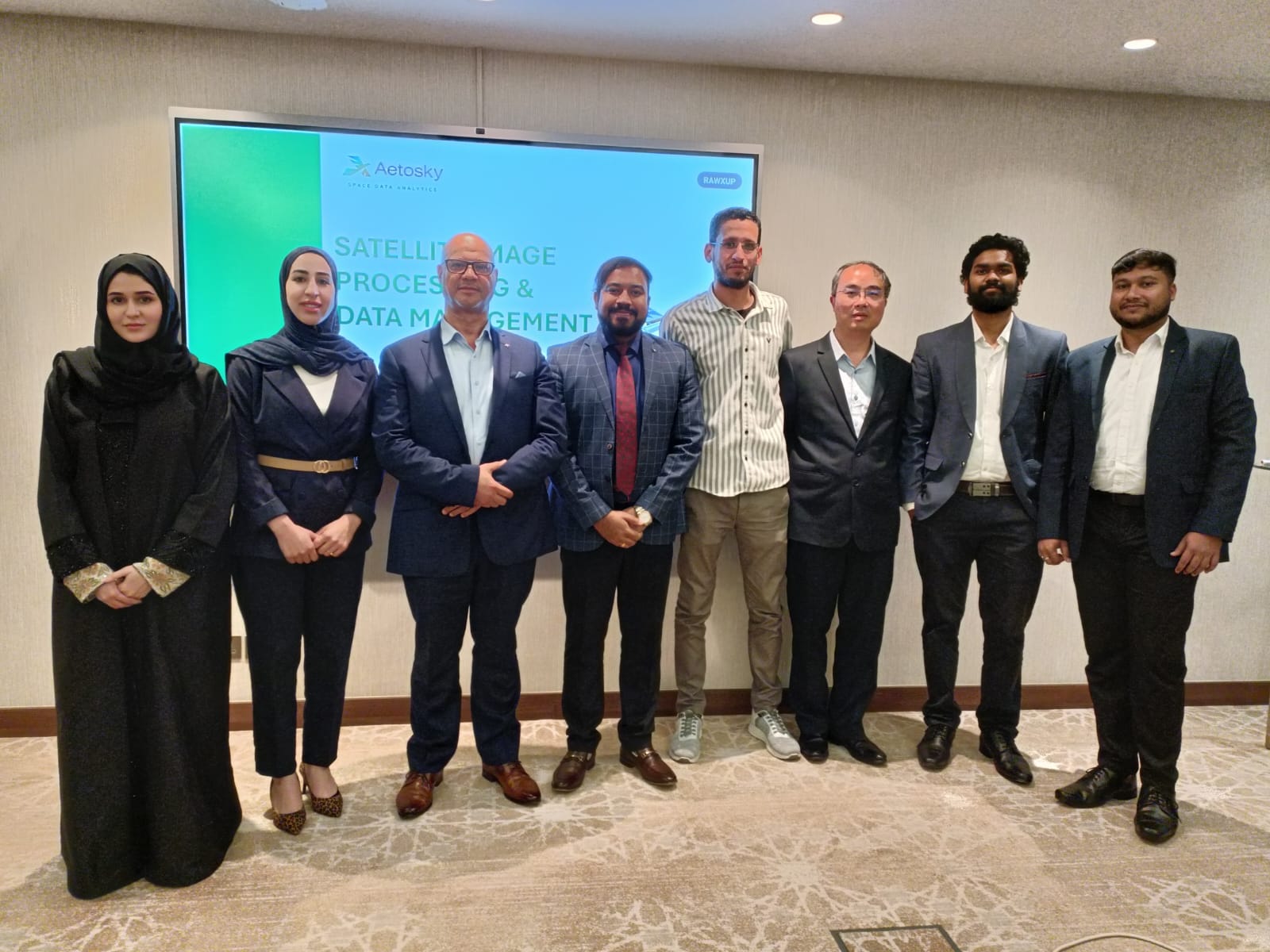
Aetosky and GISCD Implement a Game-Changing AI-Powered System for Vegetation Monitoring and Urban Intelligence


Dubai Municipality's GIS Center Department (GISCD), in collaboration with Aetosky, has successfully implemented an AI-enhanced satellite image processing and vegetation monitoring system. This initiative marks a significant step towards GISCD’s leadership in establishing sovereign geospatial capabilities, improving the precision of green area mapping in urban environments, and enhancing the interpretation of horticultural and agricultural zones.
By leveraging AI-powered image processing, geospatial analytics, and remote sensing, GISCD has strengthened its ability to monitor, analyze, and manage Dubai’s green spaces with unparalleled clarity and accuracy. This reinforces Dubai’s geospatial sovereignty, ensuring data ownership and AI-driven intelligence empower the city to independently drive its urban sustainability agenda.
GISCD: Dubai’s Central Authority for Geospatial Intelligence
The GIS Center Department (GISCD) is Dubai's leading authority on geospatial intelligence, driving the city’s vision of smart, sustainable urban planning. As the central body for all geospatial data analytics, GISCD plays a pivotal role in developing Dubai’s Digital Twin, a dynamic virtual model that integrates real-time geospatial data for proactive urban management. Through its cutting-edge AI-powered systems, GISCD is redefining how the city manages green spaces, optimizes infrastructure, and drives sustainability.
Overcoming Challenges in Satellite Data Processing
At the core of this vision is high-resolution satellite imagery, providing the foundational dataset for AI-driven insights and remote sensing applications. However, simply acquiring imagery is not enough - Dubai must process, analyze, and extract insights in a self-reliant, AI-driven ecosystem. By developing in-house AI-powered processing pipelines, GISCD ensures that Dubai’s geospatial intelligence remains secure, self-reliant, and optimized for national interests.
Challenges in Vegetation Monitoring
Dubai’s rapid urbanization and its commitment to sustainable city management demand a data-driven, AI-powered approach to vegetation assessment. However, GISCD encountered several key challenges in leveraging satellite data effectively:
Complex Image Processing Needs
High-resolution satellite imagery requires advanced correction techniques to mitigate atmospheric distortion and enhance vegetation detection.
Raw satellite imagery often contains noise, cloud cover, and inconsistent spectral clarity, making accurate analysis challenging.
Inefficient Data Processing & Analysis
Legacy systems struggled with the scale of satellite data, resulting in slow processing times and outdated insights.
Manual workflows created bottlenecks, leading to reactive rather than predictive decision-making.
Inconsistent Vegetation Assessment
Variability in data resolution and collection frequency hindered GISCD’s ability to assess and monitor vegetation health with precision.
Without an AI-driven system, land cover changes and plant stress levels were difficult to track effectively.
To overcome these challenges, GISCD required a scalable, AI-powered solution to refine satellite imagery and enhance vegetation monitoring workflows.
Aetosky’s AI-Powered Solution
GISCD, with support from Aetosky, has deployed an AI-driven image enhancement pipeline and an autonomous vegetation monitoring system. This solution enables the GISCD to extract deeper insights from satellite imagery while maintaining full control over Dubai’s geospatial data and analytics pipeline.
Core Capabilities
AI-Powered Image Processing
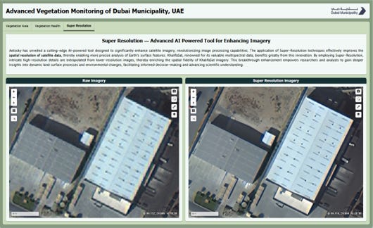
Automatically enhances imagery using AI-based feature refinement, atmospheric correction, and super-resolution modeling (2x, 4x, etc.).
Corrects atmospheric distortion using models like Dark Object Subtraction (DOS) and Radiative Transfer Models.
Supports super-resolution AI models (SRCNN, ESRGAN, etc.) to boost clarity of vegetation, water bodies, and urban features.
NDVI-Based Vegetation Health Analysis
Built-in support for NDVI, EVI, and SAVI to assess vegetation health, detect stress zones, and monitor land cover changes.
Enables multi-temporal analysis to observe vegetation trends across different time periods.


AI & Remote Sensing Integration
Employs machine learning for classifying vegetation density, canopy health, and land-use changes.
Leverages deep-learning-based Object-Based Image Analysis (OBIA) for identifying green spaces, farms, and natural vegetation.
Seamless GIS Integration
Natively integrates with GIS infrastructure to feed AI-enhanced insights directly into urban planning systems and dashboards.
Implementation & Execution: A Structured Approach
The project followed a structured four-phase approach, ensuring a seamless transition to AI-driven geospatial intelligence.
1. Image Processing & Enhancement
Optimized KhalifaSat imagery, geo-referenced datasets to Dubai’s Local Transverse Mercator (DLTM) system, and applied AI-driven atmospheric corrections.
Super-resolved images improved clarity, detected small-scale vegetation changes, and enhanced feature extraction.

2. AI-Based Vegetation Analysis
Applied NDVI, EVI, and machine learning models to classify vegetation health, detect stress zones, and identify intervention areas.
Automated land classification models distinguished between urban landscaping, natural vegetation, and barren land.
3. Capacity Building & Technical Training
Tailored Domain-Related Training Sessions
Delivered domain-specific training sessions to GISCD’s remote sensing experts.
Equipped in-house teams with Python-based geospatial scripting skills to ensure long-term sustainability of AI-powered analytics.
4. Actionable Reporting & Dashboards


Developed an interactive platform that visualizes AI-driven land classification, vegetation insights, and time-series analysis.
Provided near-instant environmental intelligence, enabling data-driven decision-making for urban planning and sustainability.
Strategic Impact: Data-Driven Urban Management
The collaboration between Aetosky and GISCD sets a new benchmark for AI-powered geospatial intelligence in urban sustainability.
Unmatched Accuracy: AI-enhanced high-resolution imagery improves the precision of vegetation health assessments, land-use mapping, and sustainability planning.
Optimized Resource Allocation: Actionable insights enable targeted conservation efforts, efficient landscaping strategies, and urban forestry management. Data-driven prioritization enhances resource efficiency in maintenance and infrastructure planning.
Informed Decision-Making: AI-powered analytics provide decision-makers with clear, near-instant intelligence for environmental conservation, land-use planning, and smart city development.
Baseline for Future Monitoring: The methodologies developed in this initiative create a foundation for continuous environmental monitoring, ensuring long-term strategic value for Dubai’s urban ecosystem.
While this project was a single assessment, the AI-powered framework is fully scalable, paving the way for a continuous monitoring system that strengthens Dubai’s geospatial self-reliance.
Global Applicability: Scaling AI-Powered Environmental Intelligence
Dubai’s AI-driven, sovereign geospatial intelligence model offers a replicable blueprint for nations seeking to reduce dependency on external geospatial platforms. This approach has broad applications, including:
• National Security & Border Surveillance
• Urban Green Infrastructure Management
• Precision Agriculture & Crop Health Monitoring
• Deforestation & Land Degradation Tracking
• Disaster Risk Management & Climate Resilience
• Infrastructure & Environmental Impact Assessment
Dubai is pioneering the future of AI-driven geospatial intelligence, setting a global precedent for cities to integrate AI, satellite imagery, and data-driven insights for sustainable urban development.
Conclusion: Pioneering the Future of Urban Intelligence
GISCD’s pioneering work, in collaboration with Aetosky, exemplifies Dubai Municipality’s commitment to achieving sovereign geospatial capabilities. By integrating satellite imagery with AI-driven autonomous analytics, GISCD is redefining how cities manage natural resources, optimize infrastructure, and build sustainable urban futures.
This next-generation AI-powered geospatial intelligence system is scalable, sovereign, and future-ready, serving as a blueprint for cities and nations worldwide to achieve AI-driven autonomy in geospatial intelligence and national decision-making.
 | A guest post by
|