
Satellite Imagery Demystified: An Analyst's Guide to AI-Powered Intel
How Analysts Can Leverage AI, Multi-Sensor Data, and Real-Time Intelligence for Mission Success


Introduction

In modern defence, security, and intelligence operations, satellite imagery is an indispensable tool. It offers unparalleled situational awareness, mission-critical intelligence, and decision support across military, government, and emergency response domains.
Yet, for many analysts, satellite imagery remains a complex and often misunderstood resource. The challenge isn’t just in acquiring images - it’s in extracting actionable intelligence efficiently, integrating multi-sensor data, and ensuring real-time responsiveness.
At Aetosky, we’ve built an end-to-end ecosystem that simplifies and accelerates geospatial intelligence, leveraging AI-driven analytics, automated rote-process workflows, and multi-sensor fusion. This article demystifies satellite imagery, covering:
Understanding Satellite Imagery: Key Dimensions and Providers
AI-Driven Intelligence: Automating Analysis
Real-World Defence and Government Use Cases
Future Trends: Continuous Monitoring, Edge AI, and Autonomy
1. Satellite Imagery Fundamentals
1.1 Core Dimensions of Satellite Imagery
Satellite imagery is defined by four core characteristics:

Spatial Resolution - Refers to the size of the smallest object that can be clearly distinguished in a satellite image. It is measured in meters or centimetres per pixel, indicating how much ground area each pixel represents. Higher spatial resolution (e.g., 30 cm) captures finer details, making it useful for applications like urban mapping and military surveillance, while lower spatial resolution (e.g., 10 m or more) is better suited for large-scale environmental monitoring and land cover analysis.
Spectral Resolution – Determines the range of electromagnetic wavelengths captured, from visible light to infrared, SAR, and hyperspectral imaging.
Radiometric Resolution - Indicates the ability of a sensor to detect differences in energy levels, measured in bits (e.g., 8-bit, 12-bit, or 16-bit). A higher radiometric resolution allows for greater differentiation in subtle variations of brightness, crucial for detecting low-contrast objects or environmental changes.
Temporal Resolution – Dictates how frequently a satellite can revisit a location, critical for tracking real-time activities and change detection.
High-fidelity intelligence demands a balance between these four factors, optimised based on mission objectives and operational constraints.
For example, intelligence agencies monitoring adversary military installations might prioritise high spatial resolution to identify vehicle types and movements. Meanwhile, environmental monitoring teams might rely on hyperspectral imaging for vegetation health analysis, while defence analysts might depend on high radiometric resolution to detect subtle thermal or reflectance differences that signal activity in sensitive areas.
1.2 Multi-Sensor Data Fusion: Optical, SAR, Hyperspectral, and Thermal
Modern intelligence operations rely on combining multiple sensor modalities:
Electro-Optical (EO) – High-resolution, natural colour imagery ideal for traditional reconnaissance and intelligence gathering.
Synthetic Aperture Radar (SAR) – Penetrates cloud cover and operates in darkness, crucial for all-weather, 24/7 monitoring.
Hyperspectral Imaging – Detects materials based on their spectral signatures, used for camouflage detection, infrastructure analysis, and environmental monitoring.
Thermal Imaging – Identifies heat emissions from vehicles, industrial facilities, and hidden military assets.
Multi-sensor data fusion requires specialised AI models that can process, align, and extract meaningful intelligence from heterogeneous data sources. The fusion process enhances detection accuracy, classification robustness, and anomaly identification across varying environmental and operational conditions.
The future of multi-sensor fusion in geospatial intelligence lies in transformer-based architectures, self-supervised learning, and real-time AI inference on edge satellites. Aetosky's AI-driven fusion models leverage many of these novel techniques to provide seamless intelligence workflows, object tracking, and situational awareness across multiple sensor modalities.
1.3 Leading Satellite Imagery Providers
Commercial Satellite Imagery Providers

Several commercial and government-backed satellite providers supply high-resolution imagery and advanced sensor data. Some of the key players include:
KOMPSAT (Korea Aerospace Research Institute) – The Korea Multi-Purpose Satellite (KOMPSAT) program, operated by KARI, delivers high-resolution optical and SAR imagery for defence, disaster management, and urban planning. The constellation includes:
KOMPSAT-3A: 40 cm panchromatic, 1.6 m multispectral, plus MWIR thermal imaging (5.5 m resolution) for environmental monitoring.
KOMPSAT-3: 70 cm panchromatic, 2.8 m multispectral, ideal for precision mapping and intelligence.
KOMPSAT-2: 1 m panchromatic, 4 m multispectral, supporting land planning, agriculture, and disaster response.
KOMPSAT-5: 1 m SAR imagery, enabling all-weather, 24/7 Earth observation for defence and maritime surveillance.
Planet Labs – Planet Labs operates one of the largest commercial small-satellite constellations, known for high-frequency, daily imagery. The constellation includes:
PlanetScope: Hundreds of Dove satellites delivering 3-meter optical resolution, ideal for change detection and environmental monitoring.
SkySat: Higher-detail 50 cm resolution, enabling urban intelligence, defence applications, and infrastructure monitoring.
MAXAR Technologies – A leader in high-resolution optical satellite imagery and geospatial analytics, MAXAR serves defence, intelligence, and commercial sectors. The company operates:
WorldView constellation: Provides sub-30 cm optical resolution, among the highest commercially available.
GeoEye satellites: Support high-precision mapping and reconnaissance.
Capella Space - Specialises in high-resolution SAR imaging, providing all-weather, day-and-night intelligence. The constellation features:
Capella SAR satellites: Offer 50 cm SAR resolution, designed for defence, maritime surveillance, and natural disaster response.
BlackSky - Focuses on real-time geospatial intelligence, leveraging AI-enhanced satellite imagery and automated analytics. The constellation includes:
BlackSky Global: 90 cm optical resolution, with high revisit rates, supporting tactical intelligence, real-time monitoring, and crisis response.
Airbus Defence and Space - Operates a diverse multi-sensor constellation, delivering both optical and SAR imagery for global intelligence applications. Key satellites include:
Pléiades Neo: 50 cm optical resolution, tailored for high-detail intelligence gathering.
SPOT satellites: 1.5-meter optical resolution, offering broad-area surveillance and mapping.
TerraSAR-X & PAZ: 1-meter SAR imaging, ensuring weather-independent monitoring.
ICEYE - A pioneer in SAR satellite technology, ICEYE specialises in high-frequency, high-resolution radar imaging for defence and intelligence. The ICEYE constellation includes:
ICEYE SAR satellites: Deliver 25 cm SAR resolution, making it one of the highest-resolution commercial SAR options available.
Beyond these major providers, there are hundreds of other satellite operators worldwide, each offering specialised capabilities. These emerging and specialised satellite constellations continue to expand global Earth observation capabilities, offering tailored intelligence solutions for various industries.
Open-Source Satellite Imagery Providers
For organisations seeking freely available satellite data, several open-source satellite programs provide valuable imagery, although they have slightly lower resolutions, they have broad global coverage. Key sources include:
Sentinel (Copernicus Program by ESA) – Provides 10m to 60m resolution imagery for land, ocean, and atmospheric monitoring. Sentinel-1 offers SAR capabilities, while Sentinel-2 provides multispectral optical data.
Landsat (NASA & USGS) – One of the longest-running Earth observation programs, Landsat provides 30m optical resolution imagery with historical archives dating back to 1972.
MODIS (Moderate Resolution Imaging Spectroradiometer by NASA) – Delivers 250m to 1km resolution imagery, widely used for global environmental monitoring.
VIIRS (Visible Infrared Imaging Radiometer Suite) – Provides 375m resolution thermal imaging, ideal for detecting wildfires, urban heat islands, and cloud cover tracking.
NOAA Satellites – Offers real-time weather and ocean monitoring data, critical for disaster response and environmental analysis.
While commercial providers offer higher resolution and specialised imaging, open-source data remains a powerful resource for long-term trend analysis, environmental studies, and disaster response operations.
How Aetos Browser Connects Organisations Across Satellite Providers

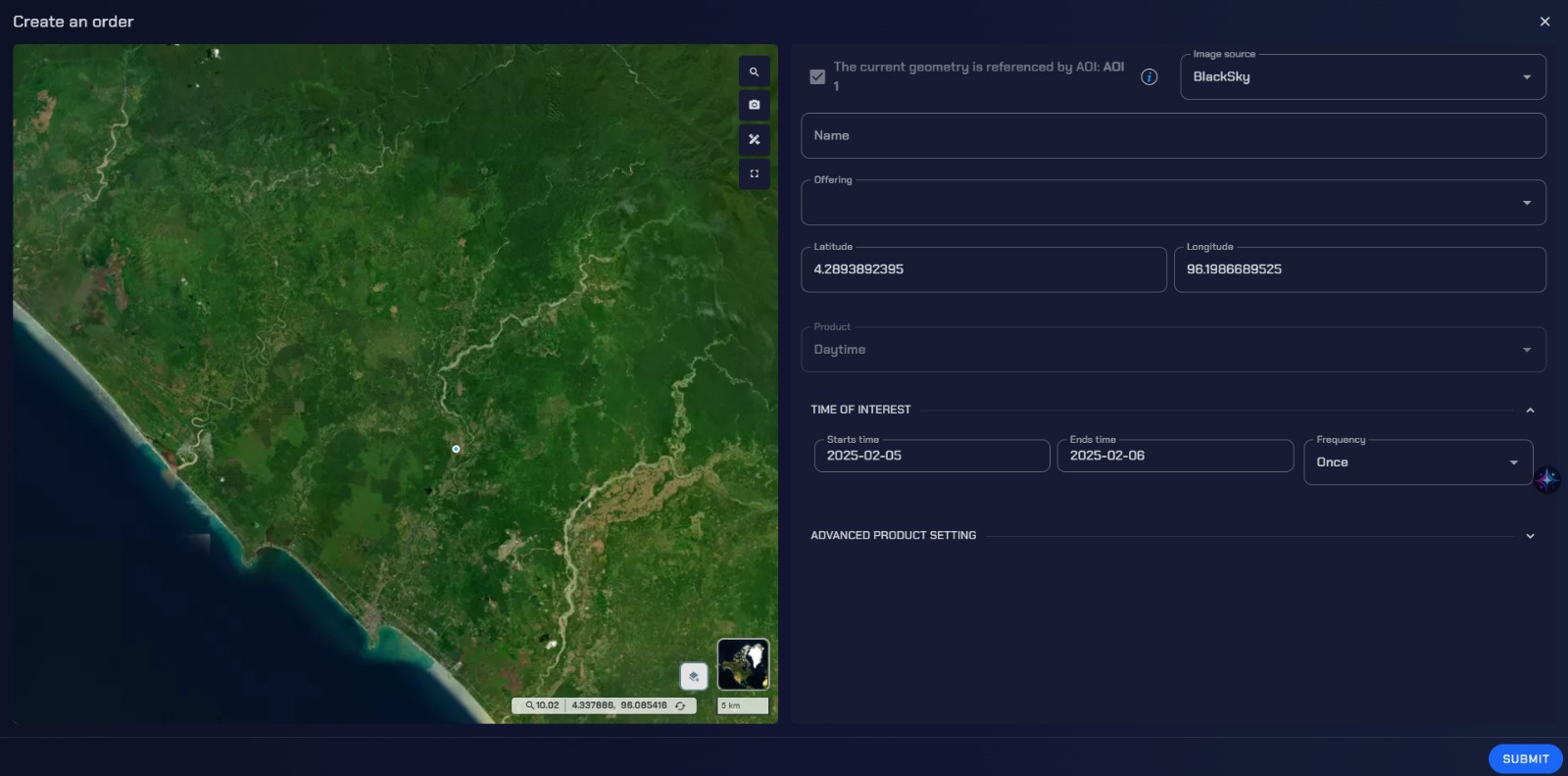
With thousands of satellites in orbit and multiple commercial and governmental providers offering various levels of imagery, Aetos Browser acts as a central hub, streamlining tasking and archive access for mission-critical intelligence across commercial and open-source satellite data. Instead of manually sourcing images from different providers, analysts can use Aetos Browser to search, procure, and analyse imagery from multiple satellite constellations in one unified interface. By integrating optical, SAR, hyperspectral, and thermal datasets, Aetos Browser provides decision-makers with a comprehensive, multi-source intelligence solution. Furthermore, its redundancy module ensures mission continuity by dynamically selecting alternative satellite sources in case of failures, restricted access, or coverage gaps.
2. AI-Driven Intelligence: Transforming Satellite Data at Scale
2.1 Automating Object Detection and Anomaly Tracking
Traditional satellite image analysis is labour-intensive and slow. Defence organisations often have thousands of analysts manually sifting through satellite imagery each day to detect and classify objects, identify anomalies, and track changes. These highly skilled professionals could be focusing on higher-value tasks, such as strategic intelligence interpretation, mission planning, and quality assurance, rather than performing repetitive, time-consuming processes. By empowering their workflows with AI-driven automation, Aetos AI allows analysts to shift from manual detection to higher-form decision-making, ensuring that intelligence operations are more efficient, actionable, and mission-focused—without replacing the critical human expertise that underpins defence intelligence.

Aetos AI powers these capabilities, reducing analyst workload while increasing detection speed and accuracy.
AI-driven automation now enables:
Near-instant object detection – Identifying aircraft, naval vessels, armoured convoys, or infrastructure developments.
Anomaly tracking – Detecting unauthorised activities, such as illegal border crossings, smuggling, or unregistered maritime movements.
Change detection – Automatically flagging shifts in terrain, military build-ups, or deforestation for intelligence review.
2.2 Predictive Analytics and Pattern Recognition
Beyond static image interpretation, AI enhances predictive modelling, allowing analysts to:
Anticipate troop movements based on historical imagery patterns.
Forecast disaster impacts before landfall by integrating weather data.
Identify economic trends by tracking global commodity storage and production.
Case Example: AI-driven models can analyse SAR data to detect unusual activity at airbases before an operation occurs, helping intelligence agencies preempt security threats.
By shifting the role of analysts from rote image interpretation to higher-order intelligence analysis, AI-driven workflows create more strategic value in defence operations, enabling personnel to focus on mission-critical insights and operational impact rather than spending hours scanning for anomalies.
3. Real-World Use Cases: Defence and Government Applications
3.1 Military and Defence Operations
Satellite imagery is integral to modern multi-domain operations (MDO), supporting:
Operational Surveillance and Reconnaissance – Monitoring adversary movements, facility expansions, and military exercises.

Strategic Site Monitoring – Providing near real-time intelligence to special forces and ground units on strategic bases across the globe.

Border Monitoring – Detecting unauthorised crossings, fortifications, and smuggling routes.

3.2 Disaster Response and Crisis Management
Governments rely on satellite imagery for disaster monitoring and rapid response:
Wildfire Tracking – Using thermal imagery to monitor fire spread and intensity.

Post-Disaster Damage Assessment – Comparing pre- and post-event imagery to guide recovery efforts.

4. Future Trends: AI, Automation, and Always-On Intelligence
The satellite intelligence landscape is evolving rapidly, with advancements in AI, automation, and real-time processing enabling faster, smarter, and more secure decision-making. The next generation of satellite technology will not only capture imagery but also analyse, prioritise, and act on intelligence autonomously through AI-driven agentic workflows.
4.1 The Rise of Continuous Monitoring
The proliferation of small satellite constellations and AI-driven analytics is making persistent, real-time surveillance a reality. With high-revisit satellites and automated monitoring, defence agencies will soon be able to:
Continuously track conflict zones with AI-powered change detection, eliminating intelligence gaps.
Monitor strategic maritime chokepoints (e.g., the Taiwan Strait, Suez Canal) in near real-time, identifying anomalies such as unauthorised vessel movements or smuggling activities.
Automate intelligence workflows so analysts can focus on decision-making rather than manually analysing thousands of images.
This shift will transform satellite intelligence from periodic snapshots to a 24/7 always-on intelligence system, where AI prioritises critical events without human intervention.
4.2 Edge AI and Real-Time Processing
Traditional satellite workflows require downlinking large volumes of raw data to ground stations before analysis, resulting in delays. Edge AI - where AI models are deployed directly onboard satellites - is revolutionising this process by allowing:
Instant alerts for critical events (e.g., troop movements, missile launches, or infrastructure changes).
Faster turnaround times for crisis response, as satellites can pre-process data and send only high-priority intelligence rather than unfiltered raw imagery.
Reduced data transmission costs, as onboard AI compresses and prioritises the most relevant insights, minimising bandwidth usage.
By embedding AI inference models on satellites, governments and defence agencies shorten the decision-making loop—moving from data collection to actionable intelligence in seconds, not hours.
4.3 AI Agentic Workflows & Self-Directed Tasking
The next step in automation is AI agentic workflows, where satellites and AI systems operate autonomously with minimal human input. These intelligent systems will:
Auto-prioritise and retask satellites based on real-time events, without waiting for manual instructions, given they have their defined budgetary constraints, etc.
Detect, analyse, and correlate patterns across different data sources (e.g., SAR, optical, hyperspectral) to build a multi-intelligence (Multi-INT) picture.
Dynamically optimise satellite tasking by balancing cloud cover and imaging priorities, ensuring maximum efficiency.
For example, if an AI system detects unusual movement in a military base, it could automatically:
Trigger high-resolution SAR imaging to penetrate cloud cover and verify activity.
Cross-reference multispectral data to check for thermal signatures.
Send immediate alerts to analysts, along with automated threat assessments based on historical patterns.
This self-directed, AI-driven intelligence workflow will be a game-changer, reducing latency, analyst workload, and reaction times in high-stakes military operations.
Conclusion: Empowering the Next Generation of Defence Intelligence
Satellite imagery is no longer just about static images—it’s about near-instant intelligence, AI-powered analytics, and multi-sensor fusion. Defence and government agencies must move beyond traditional analysis and adopt AI-driven automation, predictive intelligence, and secure multi-source integration to maintain strategic superiority. Software-enabled warfare is crucial given how current and future battlefields require more defence as the speed of the battle has increased with technological innovation.
Aetosky is leading this transformation with an ecosystem built for the future of satellite intelligence. Whether it’s AI-enhanced surveillance, automated anomaly detection, or real-time situational awareness, Aetosky delivers solutions that empower decision-makers with confidence.

For defence and government analysts looking to elevate their satellite intelligence capabilities, the time to adopt AI-driven workflows is now.
 | A guest post by
|
Interesting product you have here. Wishing Aetosky the best!