


Seeing Beyond: Turning Satellite Data into Strategic Advantage
Transforming Earth Observation Data into Mission-Ready Insights


Introduction
Satellite imagery has transformed intelligence, urban planning, disaster response, and environmental monitoring. What once required ground surveys and aerial reconnaissance can now be achieved with precision from space. However, the journey from raw satellite data to actionable intelligence requires sophisticated technology, heavy-duty analytics, and robust data infrastructure.
The Earth Observation (EO) industry has experienced unprecedented acceleration in recent years, driven by advancements in launch technology, miniaturisation, and AI-driven analytics. Companies like SpaceX have significantly reduced the cost of launching satellites through innovations such as reusable rockets and high-frequency launch schedules, allowing more companies to launch satellites.
With more satellites in orbit than ever before, innovation is compounding, making satellite imagery more accessible and powerful in driving critical decisions across defence, government, and commercial sectors.
At Aetosky, we specialise in integrating, processing, and analysing satellite data, transforming raw imagery into mission-critical intelligence. Through our intelligence platforms, we support defence operations, smart cities, and large-scale environmental monitoring, ensuring that decision-makers receive the insights they need, when they need them.
This article explores how satellite imagery is collected, processed, and transformed into high-value intelligence, ensuring seamless integration for defence, government, and commercial applications.
1. The Science Behind Satellite Information Collection
1.1 Types of Satellites and Orbits
Satellites operate in various orbits, each suited to different applications. Understanding these orbits is essential for optimising data collection, resolution, and revisit times.

Low Earth Orbit (LEO)
Altitude: 160–2,000 km
Purpose: Provides high-resolution imagery with frequent revisit times.
Applications: Urban monitoring, disaster response, defence reconnaissance.
Players: Planet Labs, Maxar Technologies, BlackSky.
Medium Earth Orbit (MEO):
Altitude: 2,000–35,000 km
Purpose: Used primarily for navigation systems like GPS, rather than detailed imaging.
Players: Lockheed Martin, Boeing, OHB System AG.
Geostationary Orbit (GEO):
Altitude: 35,786 km
Purpose: Provides constant monitoring of the same region, useful for weather tracking and communications.
Players: SES, Intelsat, Eutelsat.
1.2 Why Orbit Matters for Imagery:
Satellite data is primarily collected from Low Earth Orbit (LEO) due to its higher resolution and shorter revisit times. However, each orbit has trade-offs:
Closer satellites (LEO) capture finer detail but have a limited field of view.
Higher orbits (GEO) provide continuous coverage but lack fine resolution.
The closer the satellite is to Earth, the finer the spatial resolution it can achieve. However, being closer to Earth also means a more limited swath width (the width of the strip of Earth’s surface captured in a single pass) and a shorter revisit time. On the other hand, a geostationary platform has an enormous field of view, ideal for continuous observation but sacrifices resolution. Understanding these orbit characteristics is key to grasping why some satellites are capable of detailed images of small areas, while others capture coarse but frequent snapshots of broad regions.
At Aetosky, we specialise in harnessing insights from LEO satellite imagery while integrating multiple data sources to provide a comprehensive intelligence ecosystem.
1.3 Imaging Technologies
Satellite imaging technologies can be categorised into Passive Optical Sensors, Active Sensors, and Advanced Remote Sensing Systems, each serving unique purposes and providing different insights into Earth's surface and atmosphere.
1.3.1 Passive Optical Sensors
Passive sensors rely on sunlight reflected off the Earth's surface to capture images. These sensors are ideal for high-resolution, daytime imaging under clear weather conditions.
Visible and Infrared Imaging (Optical Sensors)
Captures natural light in the visible spectrum (e.g., Red, Green, Blue) and infrared bands.
Applications: Land cover classification, vegetation health, urban monitoring.
Multispectral and Hyperspectral Sensors
Record data across multiple wavelengths (beyond visible light), capturing fine details for material and vegetation analysis.
Applications: Detecting crop health, monitoring water quality, and mineral exploration.
1.3.2 Active Sensors
Active sensors emit their energy and measure the reflection from the Earth’s surface, allowing imaging regardless of light or weather conditions.
Synthetic Aperture Radar (SAR)
Uses microwave signals to generate high-resolution images, unaffected by weather or light conditions. SAR is widely used in defence, disaster response, and environmental monitoring.
Applications: Ship detection, infrastructure monitoring, and surface change detection.
Polarimetric SAR (PolSAR) – Advanced SAR Technique
PolSAR measures different polarizations (e.g., HH, HV, VH, VV) to provide detailed information on surface structure and composition.
Applications: Classifying vegetation types, detecting urban structures, and differentiating between natural and man-made objects.
Interferometric SAR (InSAR) – Advanced SAR Technique
InSAR compares phase differences between multiple SAR images to detect subtle changes in elevation or movement over time.
Applications: Monitoring land subsidence, detecting ice-sheet movement, and assessing structural deformation after earthquakes.
LiDAR (Light Detection and Ranging)
Uses laser pulses to measure distances, creating highly accurate 3D representations of terrain and structures. LiDAR is often used in combination with aerial or satellite platforms.
Applications: Digital terrain modelling, forestry mapping, and infrastructure assessment.
1.3.3 Advanced Remote Sensing Systems
These emerging technologies combine multiple data sources and cutting-edge techniques for deeper insights and specialised applications.
Thermal Infrared Sensors
Detect heat emissions to monitor surface temperature and energy use.
Applications: Wildfire detection, industrial heat mapping, energy efficiency.
Combined Multi-Source Imaging (Fusion of Optical, SAR, and LiDAR)
Integrates multiple sensors for a comprehensive view of the environment.
Applications: Precision agriculture, disaster response, and urban infrastructure monitoring.
2. The Mechanics of Satellite Imagery Acquisition
Unlike a handheld camera, satellite sensors must contend with various constraints, including high orbital speeds and atmospheric distortions. These systems must balance resolution, accuracy, and real-time data acquisition to ensure geometric and radiometric precision for scientific, military, and commercial applications.
2.1 Push-Broom vs. Whisk-Broom Scanning
Satellites use specialised scanning techniques to capture high-resolution imagery. In optical and multispectral imaging, there are two primary methods:

Whisk-Broom Scanning (Across-Track Scanning)
A rotating mirror sweeps side-to-side, collecting imagery in a direction perpendicular to the satellite’s movement.
A single detector (or small array of detectors) samples one pixel at a time, constructing the image line-by-line.
Older Landsat missions (e.g., Landsat 1-5) used this technique, but it has largely been replaced due to slower coverage and lower efficiency.
Push-Broom Scanning (Along-Track Scanning)
Uses a linear array of detectors, positioned perpendicular to the satellite's flight path.
As the satellite moves, each detector simultaneously captures an entire column of the image, significantly improving efficiency.
Modern satellites (e.g., Sentinel-2, WorldView-4, and Pleiades) use this technique, enabling higher resolution, stronger signal-to-noise ratios, and improved image consistency.
Because push-broom scanning captures an entire swath at once, it enables more detailed and frequent imaging, making it the preferred choice for modern Earth observation, defence, and commercial applications.
2.2 Exposure Time and Motion Compensation
Satellites in Low Earth Orbit (LEO) move at an average speed of ~7.5 kilometres per second - fast enough to travel from New York to London in under 15 minutes. This rapid motion presents a major challenge: exposure times must be precisely controlled to avoid motion blur in images.
To counteract this, satellite engineers employ:
Short Exposure Times – Ensures sharp imagery by minimising motion blur, similar to using a fast shutter speed in photography.
Time-Delay Integration (TDI) – A sophisticated technique where multiple detector elements work together to track image movement across the sensor, effectively compensating for the satellite’s motion.
Image Stabilisation & Predictive Algorithms – Some satellites apply real-time motion compensation algorithms to dynamically adjust exposure settings and minimise distortions.
These methods ensure that even with fast-moving satellites, high-resolution, blur-free images can be captured for critical applications like military reconnaissance, disaster monitoring, and change detection analytics.
2.3 Pointing Mechanisms: Achieving Precision Imaging
Unlike aerial photography, where a drone or plane can simply turn to capture different angles, satellites must use precision control systems to adjust their viewing angle. This is particularly important for targeted imaging, where satellites must focus on specific locations without waiting for their orbit to naturally bring them overhead.
Satellites Adjust Their Orientation
Reaction Wheels & Control Moment Gyroscopes (CMGs): These internal devices allow satellites to adjust their roll, pitch, and yaw, helping them point toward specific targets.
Off-Nadir Imaging: Many modern satellites can tilt their cameras to capture images at an angle, extending their view beyond their direct path.

For defence and intelligence applications, these pointing mechanisms are crucial - enabling rapid, targeted surveillance of high-priority locations without waiting for orbital repositioning.
2.4 Spectral Filters and Detector Arrays: Beyond Visible Light
Satellite sensors are designed to capture more than just visible light, extending into multispectral and hyperspectral bands to analyse vegetation health, water quality, geological formations, and urban expansion. To achieve this, satellites use sophisticated optical components to separate different wavelengths before they reach the detector array.
Multispectral vs. Hyperspectral Sensors
Multispectral Sensors (e.g., Sentinel-2, Landsat-8)
Capture a limited number of broad spectral bands (typically 4-10 bands).
Useful for vegetation monitoring, land classification, and water quality assessment.
Example Bands: Red, Green, Blue, Near-Infrared (NIR), Shortwave Infrared (SWIR).
Hyperspectral Sensors (e.g., Pixxel, Wyvern)
Capture hundreds of narrow spectral bands, providing fine-grained spectral resolution.
Essential for material identification, mineral exploration, pollution detection, and defence applications.
Example Use Cases: Detecting subtle chemical variations, identifying crop diseases, and monitoring urban heat islands.

By leveraging these advanced spectral imaging techniques, modern satellites can extract highly detailed environmental and structural insights, significantly enhancing applications in agriculture, defence, mining, and urban intelligence.
2.5 The Role of SAR (Synthetic Aperture Radar) in Imaging
While optical and multispectral sensors rely on visible and infrared light, Synthetic Aperture Radar (SAR) leverages microwave signals to generate high-resolution imagery, making it invaluable for intelligence, surveillance, and environmental monitoring. Unlike optical sensors, SAR offers:
All-Weather, Day/Night Imaging: Penetrate clouds, fog, haze, and darkness, ensuring continuous data collection in any condition.
Surface Change Detection: Widely used in defence, disaster response, and infrastructure monitoring to detect even slight ground movements, subsidence, or structural changes.
Ship & Vehicle Tracking: Satellites like Capella Space and ICEYE provide near real-time insights into naval and ground-based activities, enabling maritime domain awareness and military reconnaissance.
Imaging Under Shelters & Structures: A significant advantage of SAR is its ability to "peek" beneath certain structures, such as awnings, camouflage netting, or other overhangs. SAR satellites operating at low incidence angles (15–30 degrees above the horizon) can image areas partially obscured in optical imagery (as they typically collect imagery close to the nadir), making them critical for intelligence-gathering in military and strategic locations.

As SAR technology advances, AI-powered processing is further enhancing the resolution, feature extraction, and interpretability of SAR imagery. These improvements are making SAR-based intelligence more accessible and actionable across defence, security, and commercial applications, ensuring that critical insights are not obscured by environmental or artificial obstructions.
Bridging Image Capture to Intelligence
All these mechanical and optical processes happen at remarkable speed, capturing swaths of Earth’s surface in mere seconds. However, collecting raw imagery is just one part of the equation - before these images become useful intelligence, they must be processed, analysed, and securely transmitted to decision-makers.
3. Data Transmission: From Orbit to Ground Stations
Once collected, raw satellite data is transmitted to ground stations for processing and analysis. This process involves multiple steps to ensure secure, real-time delivery of actionable intelligence.
3.1 Downlinking: How Satellites Transmit Data

Satellites communicate with ground stations by transmitting data via radio frequency (RF) signals. These signals are received by large ground-based antennas, which capture and decode the information before forwarding it for processing. The efficiency of this transmission depends on:
Frequency Bands: Different satellite missions use specific bands (e.g., X-band, Ka-band) for optimised data transfer.
Antenna Size & Positioning: Larger, strategically located antennas improve signal reception.
3.2 Data Encryption & Security
Given the sensitive nature of satellite intelligence, data must be securely transmitted to prevent interception or tampering. This is achieved through:
End-to-End Encryption: Ensuring that raw data remains protected from the moment it is downlinked until it is processed.
Secure Communication Protocols: Satellites use encrypted telemetry and command links to prevent unauthorised access.
Anti-Jamming & Cybersecurity Measures: Advanced encryption standards protect against electronic warfare tactics, ensuring mission-critical data remains uncompromised.
3.3 Cloud-Based Processing Pipelines
Traditionally, when a satellite captures an image, it must downlink the data to a physical ground station, where the imagery is processed before it is delivered to users. However, with cloud integration, raw imagery can now be sent directly to cloud servers for real-time processing and analysis, eliminating bottlenecks.
Key Components of Cloud-Based Processing Pipelines:
Satellite Downlinking to Ground Stations
The satellite transmits raw data via radio frequency (RF) signals to ground stations.
Ground stations act as intermediaries, receiving the data before sending it to the cloud.
Data Transfer to Cloud Infrastructure
Instead of storing or processing data locally at ground stations, it is immediately pushed to cloud storage and compute environments.
This enables faster processing and global accessibility, avoiding the delays of local storage and retrieval.
AI-Powered Cloud Processing
Once in the cloud, AI algorithms can automatically preprocess and analyse the imagery, performing tasks like:
Feature extraction (identifying ships, vehicles, infrastructure changes, etc.).
Change detection (detecting urban expansion, deforestation, or disaster impacts).
Real-time analytics (generating alerts for defence, emergency response, etc.).
Delivery of Processed Data to End Users
Decision-makers can access the processed data via dashboards, APIs, or cloud-based applications, from anywhere in the world.
3.4 The Evolution of Ground Stations: Virtual Ground Stations (VGS)
Virtual Ground Stations (VGS) allow satellites to downlink data via a distributed network of antennas, rather than being limited to a single, fixed ground station.
A VGS enables any satellite to automatically connect to the nearest available antenna and relay data to the cloud.
Once the data reaches the cloud, it follows the same cloud-based processing pipeline for analysis.
So, VGS and cloud-based processing go hand in hand:
VGS handles the data reception and routing.
Cloud-based pipelines process and store the data efficiently.
This combination eliminates infrastructure constraints, allowing satellite operators to scale their operations globally without needing to maintain physical ground stations in every region.
Traditionally, satellite operators required dedicated physical ground stations with large antennas at fixed locations. However, the emergence of Virtual Ground Stations (VGS) such as AWS Ground Station and Microsoft Azure Orbital, is transforming this landscape by enabling seamless data handling without the need for dedicated infrastructure, making satellite data more accessible and operationally efficient.
Given the need for secure, real-time satellite intelligence, defence organisations are increasingly developing their own Virtual Ground Stations (VGS) to maintain sovereignty, security, and operational control. However, instead of fully replacing commercial solutions, many defence agencies are adopting a hybrid approach, combining private VGS infrastructure for classified operations with commercial cloud-based VGS for cost efficiency and scalability. This model allows defence firms to prioritise mission-critical security while optimising costs by leveraging commercial VGS providers for lower-priority or open-source intelligence (OSINT) applications.
By combining Aetosky’s secure intelligence systems with defence-grade VGS infrastructure, military and intelligence agencies can enhance their capabilities while keeping costs optimised through a hybrid VGS model.
4. Data Processing: Turning Raw Images into Intelligence
The raw images received from satellites are often distorted and require extensive processing. The process involves several key steps:
4.1. Radiometric, Atmospheric, and Geometric Correction

Radiometric Correction
Adjusts for sensor noise, illumination differences, and signal inconsistencies to ensure that pixel values accurately represent real-world reflectance or radiance.
Atmospheric Correction
Removes distortions caused by scattering and absorption due to aerosols, water vapour, and gases in the atmosphere.
Geometric Correction:
Aligns imagery to a known coordinate reference system, ensuring that every pixel is accurately mapped to its real-world location.
Systematic Geometric Correction (Without GCPs)
Precise Geometric Correction (With GCPs)
Orthorectification (With or Without GCPs)
4.2. Data Fusion: Multi-Source Integration
Integrating optical, SAR (radar), and thermal data enhances accuracy by combining different sensor strengths.
Fusing satellite imagery with UAV (drone) and ground intelligence provides a multi-layered operational picture.
4.3 Spatial Image Enhancement
Raw satellite imagery, even after these corrections, can still suffer from resolution limitations, noise, and loss of fine details. To overcome these challenges, spatial image enhancement techniques such as Super-Resolution (SR) are applied to improve the clarity, sharpness, and level of detail in satellite images.
5. Extracting Intelligence: AI-Powered Analytics and Insights
Once the data has been pre-processed, AI-driven analysis is applied to extract meaningful intelligence. Modern AI-driven platforms employ deep learning models to identify and classify objects within images:
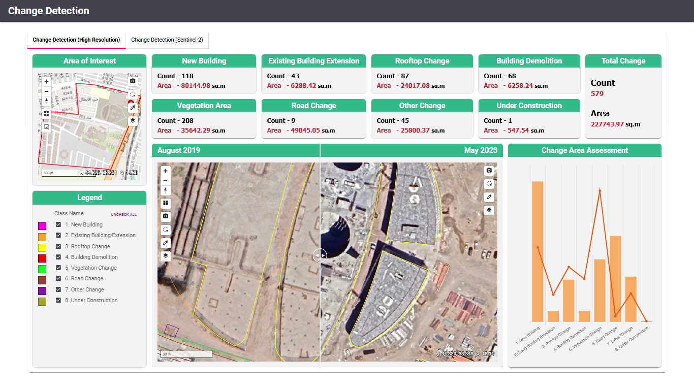
Change Detection: Analysing multi-temporal images to detect construction, deforestation, or military activities.
Object Recognition: Identifying and classifying ships, aircraft, vehicles, or infrastructure using machine learning algorithms.
Land Cover Classification: Categorising vegetation, urban areas, and water bodies for environmental monitoring and urban planning.
6. Delivering Actionable Insights: Visualising Data for Decision-Makers
Once satellite data is processed and analysed, the next challenge is making it accessible, interactive, and actionable.
6.1. Aetos Canvas
Aetos Canvas ensures that satellite-derived intelligence is not just stored but actively used to drive operational and strategic decisions:
Integrate and interact with satellite imagery, sensor data, and intelligence sources in a single interface.
Overlay, compare, and analyse geospatial datasets for applications such as urban expansion, infrastructure monitoring, and defence intelligence.
Decision-makers can visualise multi-source data, complementing satellite imagery with IoT sensor data, economic indicators, and ground reports.
Generate dynamic reports and real-time dashboards for mission-critical decision-making.
6.2. Secure Intelligence Sharing
In high-security environments, safeguarding sensitive intelligence is paramount. Aetosky ensures that mission-critical data remains protected through end-to-end encryption, controlled access protocols, and secure intelligence workflows.
Governments, defence agencies, and enterprise clients rely on classified intelligence-sharing frameworks to:
Enforce strict access controls, ensuring only authorised personnel can view and analyse intelligence.
Encrypt satellite data at every stage, from downlink to cloud storage and real-time dissemination.
Integrate audit logs and traceability features, tracking who accessed what data and when.
Implement air-gapped and hybrid-cloud architectures, balancing security with scalability.
With Aetosky’s secure intelligence-sharing infrastructure, organisations can confidently distribute mission-critical insights without compromising operational security, transforming raw satellite imagery into a trusted strategic asset.
7. Challenges and Opportunities in Satellite Imaging
As satellite imaging technology evolves, the industry faces several critical challenges that must be addressed to unlock new commercial, scientific, and defence capabilities.
7.1. Data Overload & Processing Bottlenecks
The sheer volume of high-resolution satellite data from small satellite constellations and SAR platforms is overwhelming traditional storage and processing infrastructures.
Solution: Cloud-based services, edge computing, and onboard AI processing are reducing latency and ensuring that only meaningful insights are transmitted.
7.2. Higher Resolution vs. Privacy & Security Concerns
Advances in satellite sensors now enable sub-30 cm resolution, allowing for unprecedented detail in commercial imaging.
Challenge: Striking a balance between high-resolution imaging and privacy laws while ensuring responsible data use. Space activities are regulated by international treaties, national laws, and evolving space governance frameworks. However, enforcement and compliance remain complex, as space operates under international jurisdiction rather than individual national sovereignty.
7.3. Real-Time & Persistent Monitoring Needs
Many industries require real-time satellite imagery, but downlink speeds and data relay networks are still evolving.
Solution: Innovations in optical and RF satellite communications, as well as virtual ground stations (VGS), are closing the gap between imaging and intelligence delivery.
7.4. Space Debris & Sustainability
The rapid deployment of satellite constellations is increasing orbital congestion, raising concerns about space debris and collision risks.
Solution: Future missions must integrate de-orbiting capabilities, active debris removal technologies, and international regulations for responsible satellite deployment.
7.5. AI-Driven Geospatial Intelligence
AI is transforming satellite imaging, but bias in training data, false positives in detection algorithms, and the need for human validation remain challenges.
Solution: Advanced self-learning AI models and hybrid AI-human verification workflows will improve accuracy and reliability.
At Aetosky, we are committed to driving this future by advancing AI-driven automation, sovereign space solutions, and geospatial intelligence systems that bridge the gap between space and decision-making.
Conclusion
Satellite imaging is no longer just about capturing images from space - it is about understanding, predicting, and shaping the future. The convergence of AI, cloud computing, and sovereign space initiatives is transforming the industry into an always-on, automated intelligence ecosystem.
As organisations increasingly leverage multi-source data fusion, AI-driven analytics, and secure intelligence-sharing, decision-making will become faster, more strategic, and deeply data-driven. The future of Earth observation lies not just in monitoring changes but in anticipating them, enabling governments, businesses, and researchers to take proactive action in an unpredictable world.
At Aetosky, we are at the forefront of this transformation - bridging the gap between satellite data and real-time decision-making. By integrating AI-powered automation, multi-source intelligence, and secure cloud analytics, we empower governments, businesses, and defence agencies to see further, act faster, and plan smarter in an increasingly data-driven world.
 | A guest post by
|