The Elevation Edge: Advancing Remote Sensing Through LiDAR Technology
Enabling High-Precision Terrain Analysis and Environmental Intelligence Across Domains
Enhancing Geospatial Intelligence Through Multi-Sensor Synergy
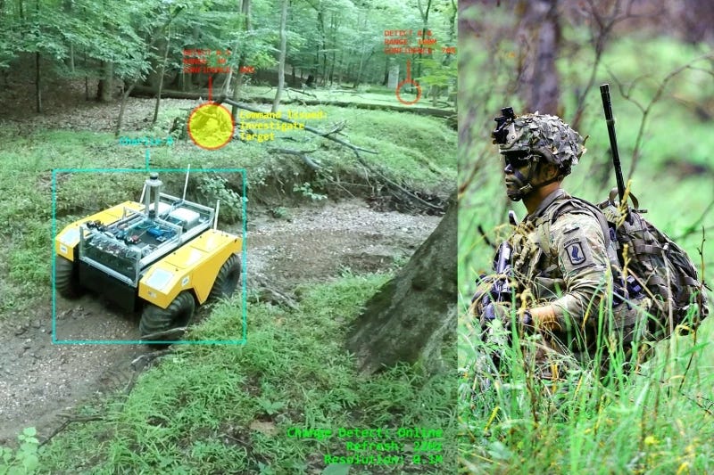
In an era of increasingly complex security challenges, the demand for high-resolution, timely, and accurate geospatial intelligence (GEOINT) has never been greater. In just a few decades, what began as a niche remote sensing method has transformed into one of the most promising and dynamic tools in the industry. Light Detection and Ranging (LiDAR) technology, through airborne or terrestrial platforms, is playing an increasingly vital role across defence, intelligence, and civil government sectors. While not a replacement for traditional satellite imagery or other remote sensing methods, LiDAR offers a highly complementary layer of insight, particularly in applications such as terrain analysis, infrastructure monitoring, and change detection.
Precision And Depth: The LiDAR Advantage
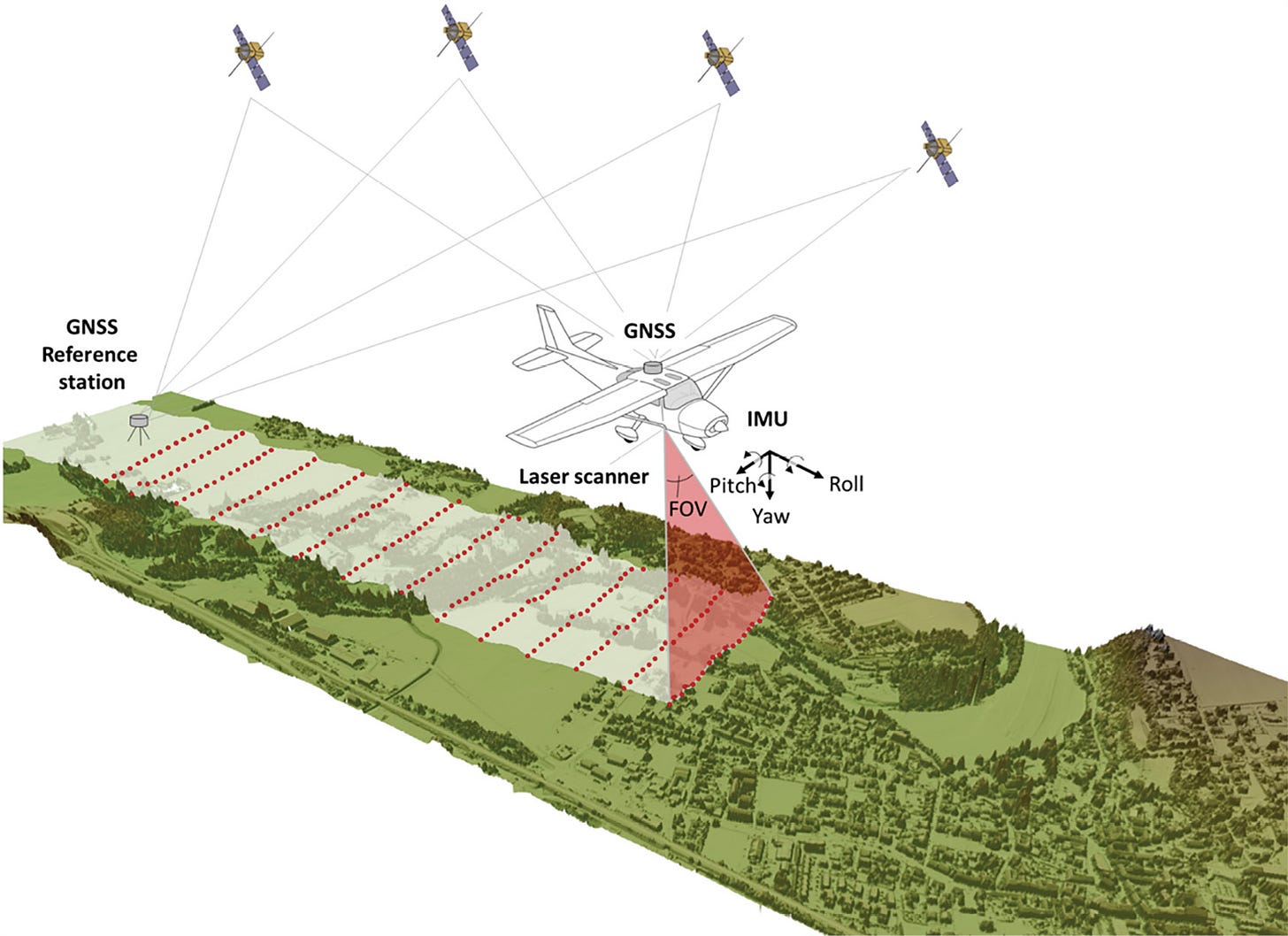
Unlike passive optical sensors that rely on sunlight or thermal energy, LiDAR systems emit laser pulses and measure their reflection time to construct highly accurate three-dimensional models of the environment. LiDAR stands out for its capability to penetrate dense vegetation and, in some cases, shallow water surfaces. Unlike photogrammetry, it operates independently of sunlight, enabling data collection in low-light or night-time conditions. This ability to generate precise Digital Elevation Models (DEMs) and point clouds enables the detection of subtle topographic features - crucial in military planning, surveillance, and disaster response.
For defence and intelligence applications, LiDAR allows users to:
Detect camouflaged structures or underground bunkers,
Map unstructured terrain with vegetation penetration,
Assess line-of-sight and field-of-fire in tactical planning,
Monitor infrastructure and assess damage post-conflict.

In civil government sectors, LiDAR is equally valuable for:
Urban planning and smart infrastructure development,
Forestry management and flood modelling,
Transportation corridor assessments,
Coastal erosion and disaster preparedness analysis.
LiDAR Data Collection And Processing
LiDAR operations are conducted using both aerial and ground-based platforms, each outfitted with specialised laser systems that emit rapid, precisely timed pulses. These pulses enable the accurate measurement of surface features, often down to millimetre-level detail.
The primary platforms used include:
Aerial LiDAR Systems: Deployed via fixed-wing aircraft, helicopters, and UAVs (drones), these systems are ideal for quickly surveying extensive or inaccessible terrain, including both topographical and bathymetric features.
Ground-Based LiDAR Scanners: Positioned on tripods, mounted on vehicles, or operated manually, these devices provide highly detailed scans of structures, landscapes, and built environments from the ground level.
Uncrewed Surface Vessels (USVs): These compact, remotely operated or autonomous watercraft carry LiDAR and supporting sensors, making them effective for mapping shallow waterways, coastal zones, and harbour environments.
Ship-Mounted LiDAR Arrays: Installed aboard research or survey vessels, these systems support coastal and sea ice mapping and enhance sonar-based bathymetric surveys by capturing above-water features like cliffs or shorelines.
LiDAR And Change Detection: A Strategic Use Case
One of LiDAR’s most impactful applications is in change detection. By conducting repeated LiDAR surveys over the same area, decision-makers can identify alterations in terrain, construction activities, environmental degradation, or unauthorised land use. The millimetre-level elevation data it provides makes it possible to detect even minor changes in topography or built environments. When using LiDAR technology for change detection or landscape analysis, having access to high-quality data is essential. Thankfully, an increasing number of online resources such as the USGS 3D Elevation Program (3DEP) - now provide LiDAR datasets for numerous global regions. However, effective analysis depends on obtaining two datasets that cover the same geographic area but were captured at different points in time.
This change detection capability is especially important in:
Border monitoring and illegal encroachment detection,
Post-disaster damage assessment for rapid emergency response,
Infrastructure degradation over time (e.g., bridges, dams),
Monitoring of deforestation or land subsidence.
Pros And Cons Of LiDAR Technology
While LiDAR technology excels in detecting landscape changes with exceptional accuracy, it also comes with notable limitations. One primary drawback is the high cost associated with LiDAR data acquisition, which stems from the advanced equipment and substantial processing power required. Additionally, environmental factors such as adverse weather or extremely dense vegetation can interfere with the laser pulses, potentially causing data gaps or reducing the overall precision of the output.
Another significant constraint is the non-continuous nature of LiDAR data collection. Unlike satellite systems that capture imagery at regular, scheduled intervals, LiDAR surveys are typically conducted on a project-by-project basis. These data collection efforts are often irregular, driven by specific needs, funding availability, or access to the target location. This lack of temporal consistency can pose challenges for applications that rely on frequent updates to monitor ongoing environmental or urban changes.
Nonetheless, the strengths of LiDAR remain extensive, particularly in the realms of change detection and terrain analysis. A major advantage is its ability to classify different surface features - such as distinguishing between vegetation, man-made structures, and water. This makes it a powerful tool for detailed landscape mapping. LiDAR also offers high spatial accuracy, often within just a few centimetres. Furthermore, its capacity to generate detailed 3D models of the terrain provides enhanced insight into spatial structures and relationships.
LiDAR Use In Aquatic Environments
In coastal and marine settings, LiDAR technology retains its foundational principles but is specially adapted to function below the water's surface. Bathymetric LiDAR employs green-wavelength laser pulses capable of penetrating clear, shallow waters, enabling it to measure both the water surface and the seafloor beneath.
By capturing two distinct returns, one from the water surface and one from the bottom, this system can generate precise maps of underwater terrain. It is especially effective in areas such as coral reefs, estuaries, and nearshore environments where conventional hydrographic techniques may struggle. Typically mounted on low-altitude aircraft, bathymetric LiDAR sensors can rapidly collect large volumes of data, making them particularly suited for expansive or changing coastal regions.
The raw data is adjusted for variables like water depth, surface waves, and light refraction to create reliable three-dimensional representations of submerged landscapes. These outputs are instrumental in applications such as coastal erosion tracking, flood modelling, marine navigation, and habitat assessment.
Real Life Use Cases Of LiDAR Technology
1. Abu Dhabi Urban Planning Council
In the UAE, the Abu Dhabi Urban Planning Council (UPC) has utilised LiDAR data as part of its Plan Abu Dhabi 2030 initiative. LiDAR was employed to produce high-resolution topographic and built-environment data to support urban zoning, drainage planning, and environmental impact assessments. The integration of LiDAR data with GIS and CAD platforms allowed the UPC to model future growth areas and optimise infrastructure investments while preserving environmentally sensitive regions.
2. LiDAR Mapping for NEOM
Saudi Arabia’s NEOM project, a $500B smart city initiative, has leveraged aerial and satellite-based LiDAR to map vast stretches of desert and coastal terrain along the Red Sea. The LiDAR data supports 3D modelling, slope stability analysis, and infrastructure routing in remote, geotechnically complex areas. The data is crucial for ensuring sustainable land development and early-stage environmental preservation in a project expected to span 26,500 square kilometres.
3. Indonesia’s National Mapping Agency
Indonesia’s Badan Informasi Geospasial (BIG) has deployed LiDAR across several provinces to produce detailed elevation maps in support of disaster mitigation and national spatial planning. The data has been used to map volcanic slopes (such as Mount Merapi), assess landslide-prone areas, and guide emergency evacuation route design. The agency also uses LiDAR to monitor coastal erosion and urban sprawl, integrating this with satellite imagery and UAV data.
Complementary, Not Competitive: The Role of Multi-Sensor Integration
While LiDAR offers unique advantages, it is not a standalone solution. It is most effective when integrated with other sensor data, such as:
Satellite imagery for broad-area situational awareness and spectral analysis
Synthetic Aperture Radar (SAR) for all-weather, day/night imaging
Multispectral and hyperspectral sensors for vegetation, water quality, or material analysis
UAV (drone) imagery for hyperlocal assessments in inaccessible regions.
Such fusion of sensor modalities leads to a richer, multidimensional intelligence picture. For instance, using satellite data to monitor an area at a macro level can help identify anomalies, which can then be targeted with airborne LiDAR for detailed analysis.
Looking Ahead
As threats evolve and governments grapple with dynamic environmental and geopolitical challenges, the role of LiDAR is poised to expand. With increasing access to high-altitude platforms, miniaturised sensors, and advanced AI-based point cloud analytics, the integration of LiDAR into modern GEOINT frameworks will only deepen.
By embracing LiDAR as a complementary - not alternative technology to traditional remote sensing - defence and civil agencies can achieve unmatched precision, continuity, and actionable intelligence in their missions. Aetosky’s continued investment in LiDAR-driven innovation ensures that our clients stay ahead of emerging threats, environmental risks, and evolving urban demands - reinforcing our commitment to precision, reliability, and next-generation mission support.


