
The Future Of 3D Analytics For Resilience
Turning Data Into Decision-Grade Intelligence with AI-Driven 3D Mapping


In a world that is increasingly data-driven, the ability to see and understand our environments in three dimensions has become a necessity, not a luxury. From national defense operations to urban planning and disaster response, leaders across industries require realistic, interactive, and intelligent 3D representations of the world to make informed decisions.
Traditionally, maps were flat and two-dimensional. While effective for basic navigation, they lacked the depth and precision required to manage today’s complex challenges. This is where 3D geospatial analytics, powered by AI and remote sensing (GeoAI), is redefining how we perceive and plan for our surroundings.

From Topographic Maps to Digital Elevation Models
At the heart of 3D analytics are Digital Elevation Models (DEMs) and Digital Surface Models (DSMs). These datasets, created using high-resolution satellite imagery and photogrammetry, replicate the Earth’s terrain with remarkable precision. DEMs represent the bare earth, while DSMs include surface features such as buildings, vegetation, and infrastructure.
When fused with AI-based feature extraction, these models become far more powerful. Planners and engineers can automatically detect slopes, contours, man-made structures, or even changes in terrain over time-insights that are crucial for corridor planning, aviation, telecommunications, mining, and large-scale engineering projects.
In defense, elevation and slope data underpin mission planning, surveillance, and tactical decision-making. For urban developers, they are essential for simulating drainage systems, visualising city skylines, and designing resilient infrastructure.
Beyond Visualisation: The True Value of 3D Data
A common misconception is that 3D geospatial data is simply a visual effect. In reality, it is much more-it represents a precise, measurable, and scalable dataset. Every building model, terrain slope, or flood simulation can be tied to real-world coordinates and measurements.
This transforms 3D data from being merely illustrative to being operational intelligence. Engineers use it to calculate cut-and-fill volumes in construction projects. Disaster management agencies rely on it to identify safe evacuation routes. Defense analysts use it to understand terrain obstacles before deploying troops.
The precision is not abstract-it directly affects lives, costs, and mission success.
3D GIS: Adding the Third Dimension of Insight
Traditional GIS (Geographic Information Systems) have long been used to analyse two-dimensional datasets-roads, parcels, and infrastructure layouts. 3D GIS takes this further by incorporating the z-axis, allowing for modelling of elevation, height, and subsurface conditions.
Modern 3D GIS enables a city planner to simulate how new high-rises will cast shadows over streets, or how new transport routes will affect underground utilities. Defense forces can simulate complex terrains for training and operations. Urban agencies can integrate real-time IoT sensor data into 3D city models, effectively creating digital twins that evolve with reality.
The ability to overlay multiple datasets-buildings, terrain, utilities, vegetation, climate models-provides a single environment where stakeholders can see interactions that were invisible in 2D

Smart Cities and Urban Transformation
Urban centres are rapidly becoming the engines of economic growth, but they are also facing immense pressure: population density, climate risks, and infrastructure stress. 3D geospatial analytics is becoming a cornerstone of smart city initiatives worldwide.
By combining BIM (Building Information Modelling) with 3D GIS, cities can visualise future developments, evaluate their impacts, and test scenarios before investing millions into infrastructure. This is critical for utilities management, transport planning, and even energy efficiency studies.
Imagine being able to simulate how traffic flows will change after introducing a new metro line-or how storm surges might impact coastal housing communities. With 3D analytics, governments can make evidence-based, forward-looking decisions.
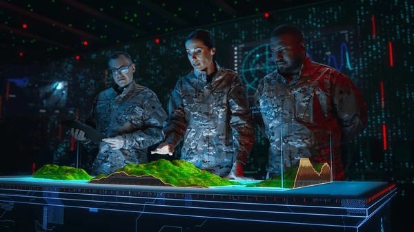
Defense and National Security Applications
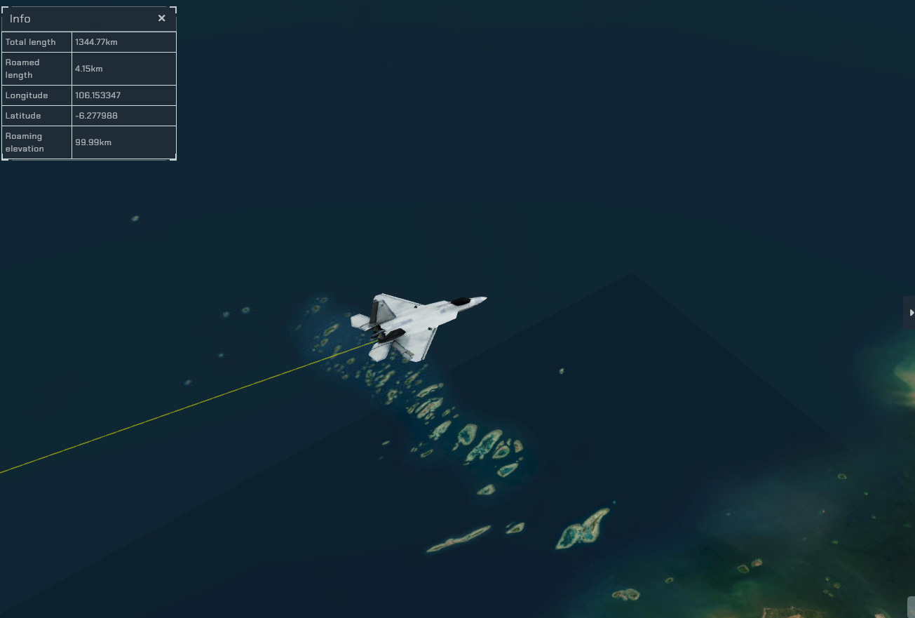
In the defense sector, speed and accuracy of intelligence can determine mission outcomes. For decades, militaries have relied on aerial photography and photogrammetry. Today, advances in AI and 3D modelling allow forces to replicate entire terrains digitally, providing immersive environments for mission rehearsal and operational planning.
Border surveillance, counter-terrorism, and strategic defense operations now rely on AI-powered 3D terrain models that automatically detect changes in landscapes, track movements, and highlight potential vulnerabilities. Commanders can simulate routes, identify choke points, and make decisions with a clear understanding of the geographic reality on the ground.
This is where Aetosky’s GeoAI-driven 3D analytics platforms provide a significant advantage-delivering decision-grade intelligence in near real time.
Disaster Response and Climate Resilience
As climate change accelerates, 3D geospatial analytics has emerged as a vital tool for climate adaptation and disaster management. Flood modelling, storm surge simulations, and sea-level rise scenarios can be overlaid onto community infrastructure to identify vulnerable zones
During disasters, 3D mapping provides rescue teams with detailed terrain intelligence, helping them select evacuation routes, avoid hazards, and coordinate relief efforts. Unlike static 2D maps, 3D data provides responders with an immersive and accurate picture of the ground reality, allowing for faster and safer decisions.
Aetosky’s Role in Building the Next Generation of 3D GeoAI
At Aetosky, we are at the forefront of building AI-powered 3D geospatial analytics platforms for both defense and urban clients. By combining high-resolution remote sensing data with advanced machine learning, we create models that are not only visually compelling but also analytically robust.
For defense clients, our platforms deliver operational terrain intelligence-supporting border surveillance, mission rehearsal, and change detection. For urban clients, we provide smart city digital twins that integrate BIM, IoT, and climate models, enabling planners to design resilient infrastructure and simulate future scenarios with confidence.
Our mission is simple: to empower decision-makers with the clarity of 3D insight, the precision of AI, and the scale of satellite intelligence.

The Road Ahead: GeoAI as a Strategic Enabler
The fusion of 3D GIS, BIM, AI, and remote sensing is reshaping industries. Defense agencies gain faster, more accurate intelligence. Urban governments create smarter, more sustainable cities. Emergency responders save lives with better situational awareness.
3D geospatial analytics is no longer just about mapping the world-it’s about understanding it, predicting it, and shaping it. As the demand for digital twins and real-time spatial intelligence grows, organisations that embrace GeoAI will gain a decisive edge in both planning and execution.
At Aetosky, we believe the future of decision-making lies in seeing the world not just as it is, but as it will be-through the lens of intelligent 3D analytics.
 |
|